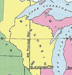
 A grid was drawn across Wisconsin, the southern boundary along Illinois or baseline being the east-west starting point and a line drawn north and south from a point on the western end of this baseline about 10 miles east of the Mississippi River ( principal meridian.)
 From these coordinates a line was marked every 6 miles in each direction, thirty lines to the east, twenty lines to the west (Township lines,) and fifty-three to the north (Range lines.) This divided the state into six mile square sections called townships.
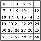
Townships were further divided into 36 one-mile square sections that were numbered like this:
Outagamie County is bordered by Township 21 North (T21N) to Township 24 North (T24N) and Range 15 East (R15E) to Range 19 East (R19E).
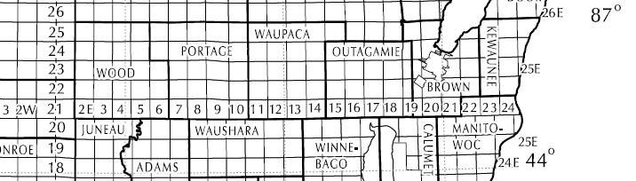
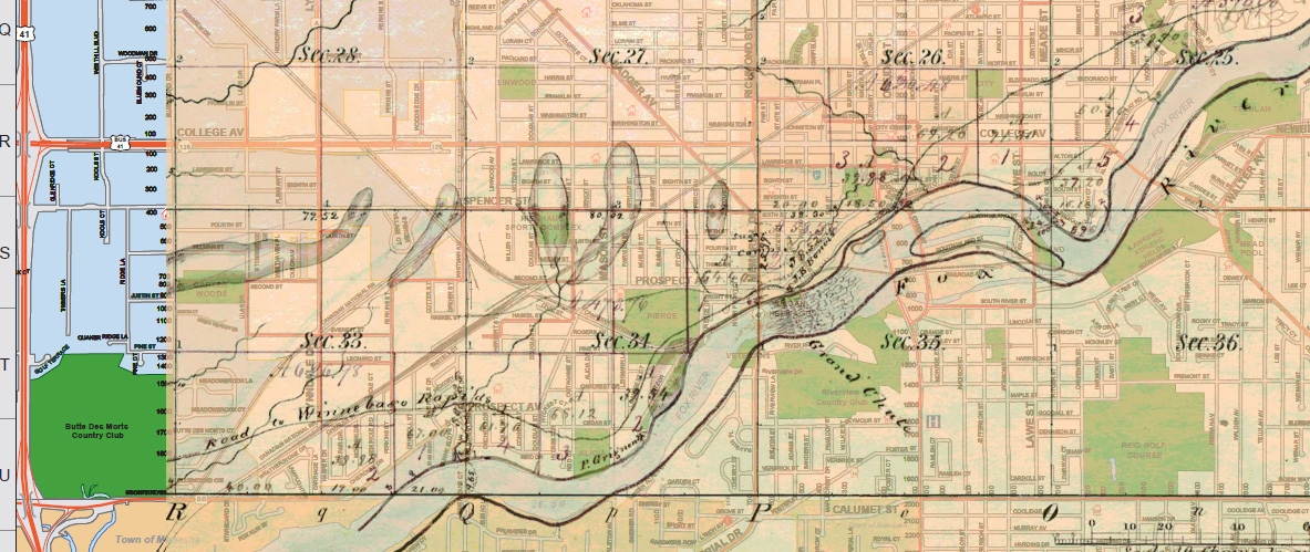
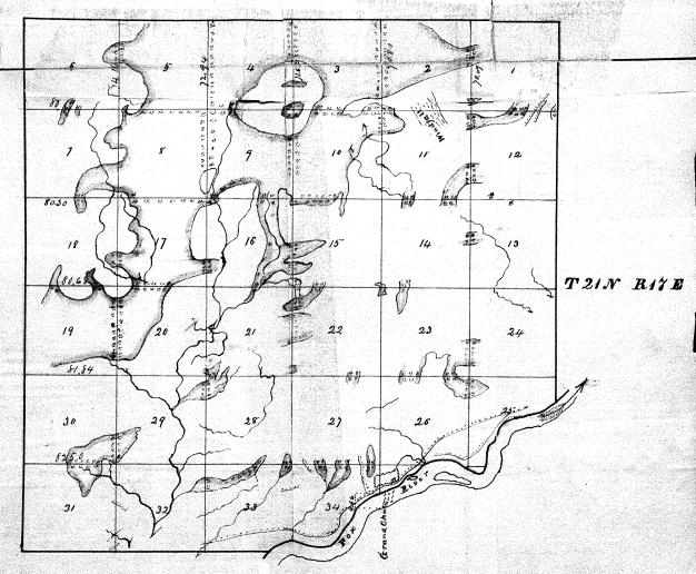 The original sketch map from the interior field notes taken by Theodore Conkey in November of 1843 the shows the present city of Appleton lies within the coordinates T21N and R17E.
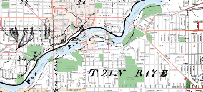 The Old Third Ward is located in Section 26 and the far northwest corner of Section 35.
 Why does this matter? Legal descriptions of property in 19th century records often include these indicators. To discover where someone lived or where property was located, understanding the PLSS is essential.
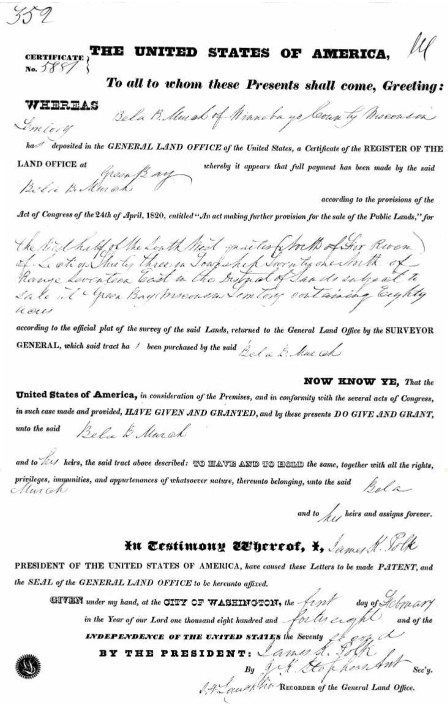
For example, in 1846 Bela Murch became the first farmer to settle in what is now Appleton. Two year later he purchased the land. Left is an image of the land patent for this sale with the inscription: "The west half of the south west quarter north of the Fox River of section thirty three in Township Twenty one North of Range Seventeen East in the District of lands subject to sale at Green Bay Wisconsin Territory contains eighty acres." This locates the property on W. Prospect Ave. bordering the Butts Des Mortes County Club.
Images of the original surveys are contained in the document Wisconsin Public Land Survey Records:
Original Field Notes and Plat Maps