By the 1830's there were several settlers living on the north bank of the Fox River, but they did not own the land on which they made their homes. In order to purchase land, a survey needed to be carried out. Any buyers, whether they be residents or speculators, would need a detailed description of the land and borders would need to be drawn.
John H. Mullett and John Brink produced Exterior Field Notes in 1834 for Township T21N Range R17E, the area which is now most of the city of Appleton. For a detailed description of the Public Land Survey System (PLSS) see "Surveying". Their notes are striking in the abundance and variety of trees described: black oak, sugar maples, elm, aspen, ash, hickory and beech. In January of 1839 Garret Vliet surveyed townships lines. Later (June 5-13, 1843), A. G. Ellis took fields notes of a survey of township lines.
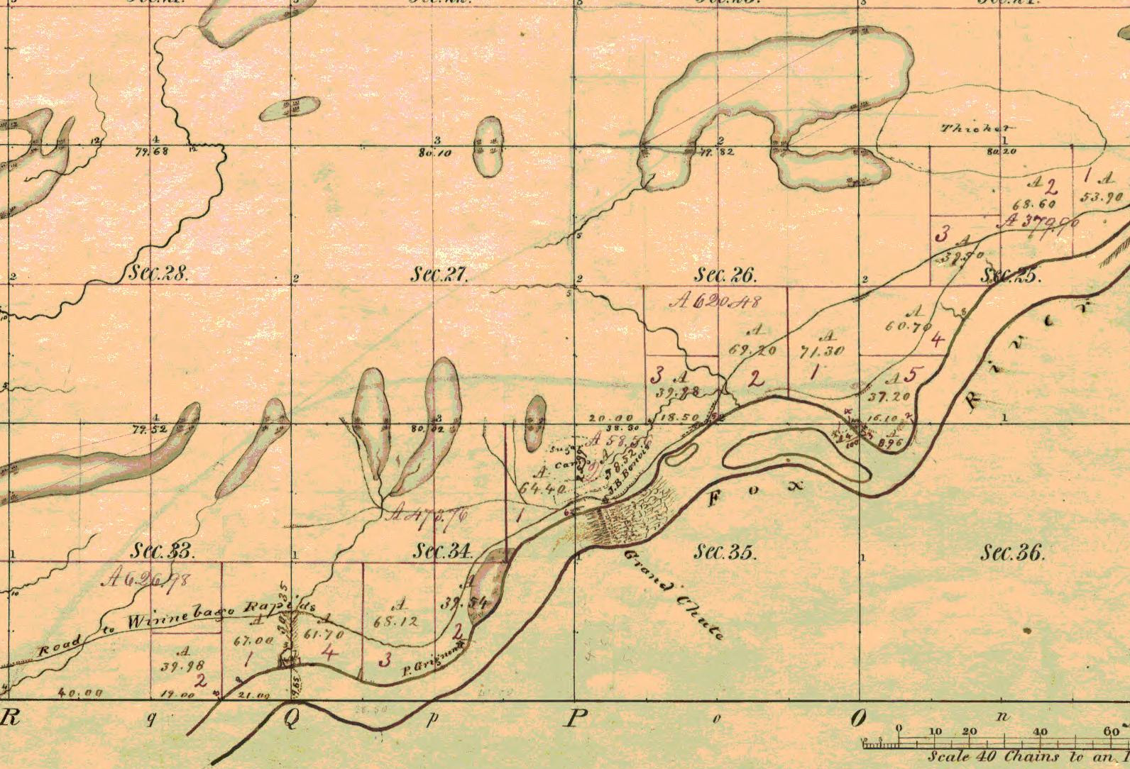
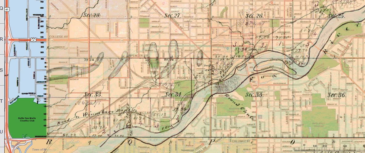
An overlaying of the plat map shows a remarkable correlation between the modern map and the map from over over 150 years ago. The boundaries between sections 27 and 26, 34 and 35 line up with S. Memorial Dr., Meade St., Spencer St. and Calumet St.
Images of the original surveys are contained in the document Wisconsin Public Land Survey Records: Original Field Notes and Plat Maps